|
Photo Gallery: click on any photo
|
Route Map
|
|
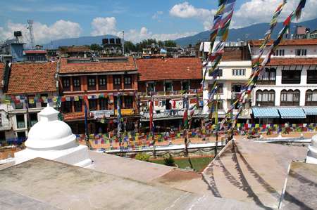 |
Capital City:
Kathmandu counts 850.000 inhabitants and is Nepal's biggest city by
far.
Together with neighbour towns Patan and Bhaktapur the area is home to
more than 1.5 mio people.
|
|
 |
Saved:
Kathmandu valley is a UNESCO World Heritage Site since 1979.
However, many old buildings are in danger. Often they are demolished to
build completely new premises, using concrete mostly. |
|
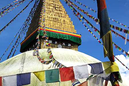 |
Important:
In Bodnath, a suburb in the North East of Kathmandu, the biggest
Nepalese
Stupa hosts devout Buddhists. It is the most outstanding sanctuary of
their religion in the country. |
|
 |
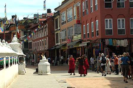
Active:
Durbar Square is the centre of the capital's life. Here one finds the
old Royal Palace and a confusing collection of sanctuaries and art. |
|
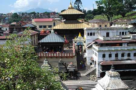 |
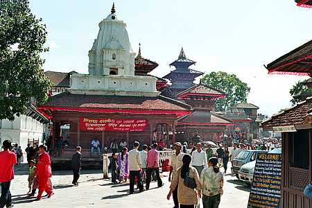
Closed:
Pashupatinath is the Hindu centre of Nepal. It is a district with a
dense tangle of temples and pagodas, pilgrim homes and last residences.
The main temple of God Shiva is situated on the banks of the holy river
Bagmati and is open only to Hindus. |
|
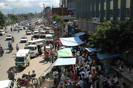 |
Local traffic:
Few roads are as broad as Kanti Path besides Ratna Park.
Private cars are rare, but there are lots of mopeds instead. Most
vehicles are small busses or taxis.
Often roads are lined with markets. |
|
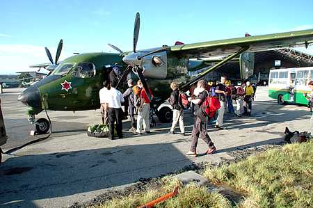 |
Kathmandu Airport:
Tribhuvan International Airport is the country's only international
airport. The valley of Kathmandu is surrounded by high mountain ridges
which rise up to 2700 meters. The approach is possible just from the
South.
The military plane will take us to Lukla, a village at 2800 meters in
the Kumbhu district. |
|
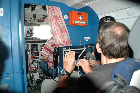 |
Insight:
The curtain stays open during the flight, allowing the passengers to
enjoy the journey in its full tension.
|
|
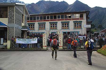 |
Arrival at high
level:
The tourists are welcomed by countless on-lookers and porters, guides
and merchants hoping for business.
As long as the sky is free of clouds planes come and go frequently. |
|
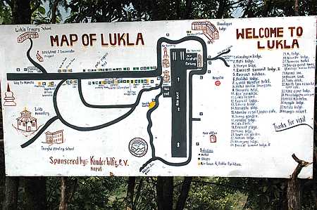 |
Village map:
There is a good selection of shops at
Lukla, however you will find a much broader offer at the market town of Namche Bazar
which will be reached after 2 days of trekking. |
|
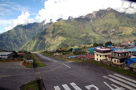 |
Short slope:
Lukla is a so called STOL Airport: Short Take
Off and Landing. You might take these words literally.
The runway is 500 meters long and has an incline of 15% what helps to
slow down after landing and to increase speed to take off. |
|
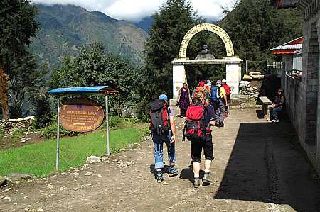 |
Marching off:
Yet on the same day we leave Lukla for the first stage of our trekking
route. |
|
 |
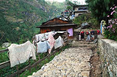
Easy stroll:
The paths along the valley are prepared perfectly and absolutely safe.
For hundreds of years the village people have got their provisions
carried along here.
Tourists don't have to starve along the route. Many restaurants and
lodges compete to care for the trekkers. |
|
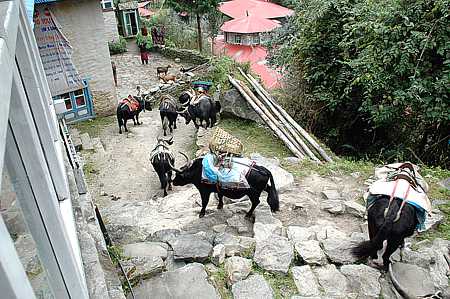 |
Pack-animals:
Cattle found along the lower valleys are not original Yaks but crossed
between Yak and cow, called Dschok-Pa. They are slightly smaller and
their fur is shorter. They would not be able to survive at more than
4000 meters. |
|
 |
Village High
Street:
At Monjo, half way
from Lukla to Namche Bazar, we stay overnight for the first time. |
|
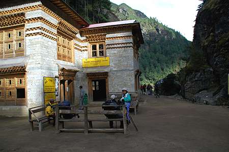 |
Park Gate:
Every trekker has to
pay a fee for the visit of
Sagarmatha National Park. Sagarmatha is the Nepalese name of Mount
Everest. |
|
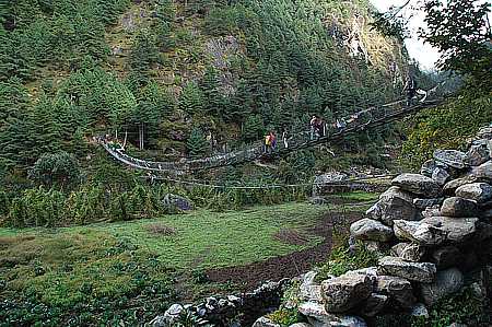 |
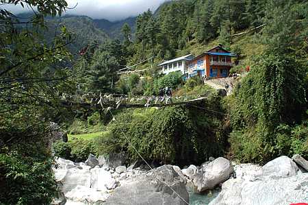
Comfortable:
Several times one has to cross the river Dudh Koshi. The modern
suspension bridges are made of solid wire ropes, and the swinging is
restricted. |
|
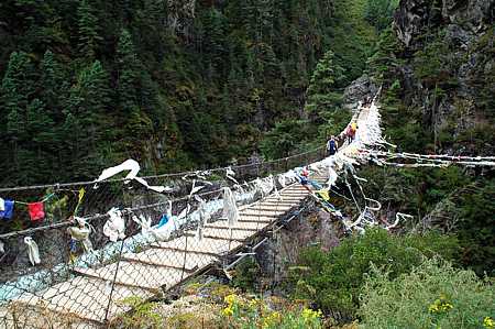 |
Airy:
It is just the famous and particularly high Hillary Bridge which still
is made of wooden planks and its handrail stays below a sedating height -
maybe for nostalgic reasons. |
|
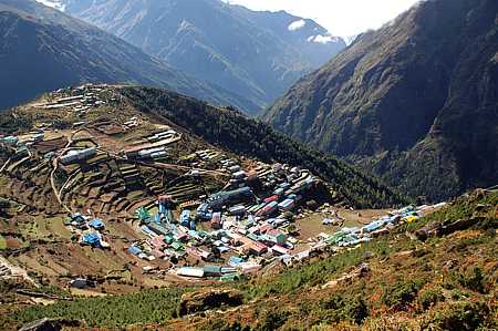 |
Hillside village:
The prosperous market town of Namche Bazar is the shopping centre for
locals and tourists.
Most of the organised trekking tours rest here for an additional day of
acclimatisation. |
|
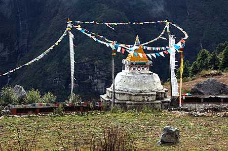 |
Sanctuary:
A Stupa is the obligatory religious facility like a chapel in the
European Alps. |
|
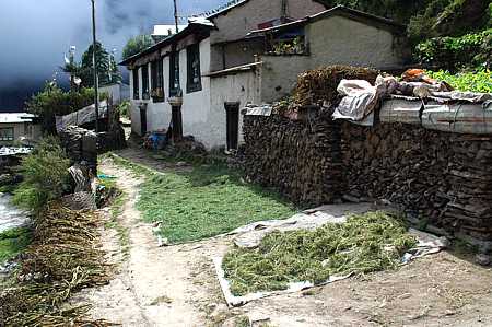 |
Mountain Farming:
Every little plain is used for a fruit and vegetable garden. The crop
is sun dried on the path. |
|
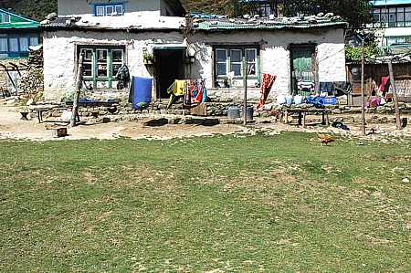 |
Private:
This is one of the very few houses in Namche Bazar, which is not put up
as a lodge,
restaurant or shop. |
|
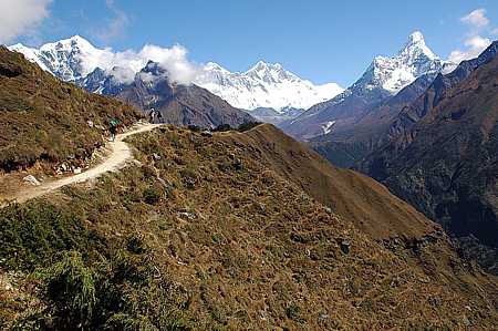 |
Finally:
During the day trip from Namche Bazar to Everest View Hotel one faces
it for the first time: The top of the world. To the right is the
mountain which many regard as the most beautiful one in Nepal: Ama Dablam.
To the left the ridge of
Nuptse and Lhotse, hiding Everest which is only visible with its
summit. |
|
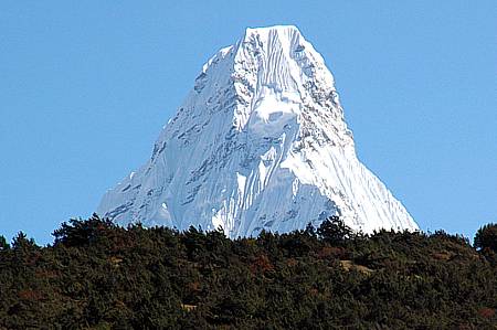 |
Close by:
The summit of Ama Dablam (6812m) was climbed first in 1961.
Expeditions with usually 3 high camps are offered by professional
mountain guide companies.
Climbing at the 5th alpine grade and ascending ice walls of up to 50°
should be within the capabilites of interested mountaineers.
A couple of weeks after this photo was taken in November 2006 a serac
broke off the "Dablam" (ice amulet) and destroyed the high camp placed
below. 6 mountaineers died.
(read
Everest News).
> next page |